Crystal Beach Resort History
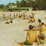
We stumbled on an interesting map that appears to show an old water park. After some investigation, we discovered that it was a popular summer-time destination called Crystal Lake, located in a rural part of Irwin County Georgia. The postcard below shows the pavilion and beach, as it looked in 1964. Apparently, the lake would occasionally dry […]