Vermilion Lake Topo Map in St. Louis County MN
Vermilion Lake Information
Coordinates: 47.89209°N, -92.37487°W
Approx. Elevation: 1,358 feet (414 meters)
USGS Map Area: Vermilion Dam
Feature Type: Lake
Nearby Lakes
| Feature | USGS Topo Map |
|---|---|
| Wolf Lake | Vermilion Dam |
| Lost Lake | Lost Lake |
| Trout Lake | Sioux Pine Island |
| Merritt Lake | Sioux Pine Island |
| Pine Lake | Chad Lake |
| Little Lost Lake | Lost Lake |
| Bass Lake | Chad Lake |
| Oriniack Lake | Astrid Lake |
| Dugout Lake | Chad Lake |
| Lake Alf | Picket Lake |
Vermilion Lake (or Lake Vermilion) is a large freshwater lake in Northern Minnesota’s Arrowhead Region and Saint Louis County. The nearest towns are Tower and Soudan, but Cook is nearby to the west and Ely is just east. There are very few roads and towns north of the lake but you can explore that area by boat in Boundary Waters Canoe Area Wilderness (BWCAW) and Superior National Forest.
Vermilion is not a deep lake (about 25 ft deep on average), but that doesn’t stop anyone from fishing or recreating on the lake. The size of the lake is nearly 40,000 acres (39,270 to be exact) which makes it the fifth largest lake in the state. The largest is Red Lake with two parts, Upper Red Lake and Lower Red Lake, combining for 288,800 acres.
The elevation of Vermilion Lake varies but on average it’s about 1358 feet (420 meters). It’s full of islands, coves, bays, and narrows which lead to different parts of the lake.
The name of the lake comes from the Latin word for red. The Native Americans who lived in the area described Vermilion Lake as looking red in the sunset’s glow.
Below is a static map of Vermilion Lake which you can click on to view full size, but if you want a dynamic map with the ability to pan in all directions and zoom in an out, click on the map above.
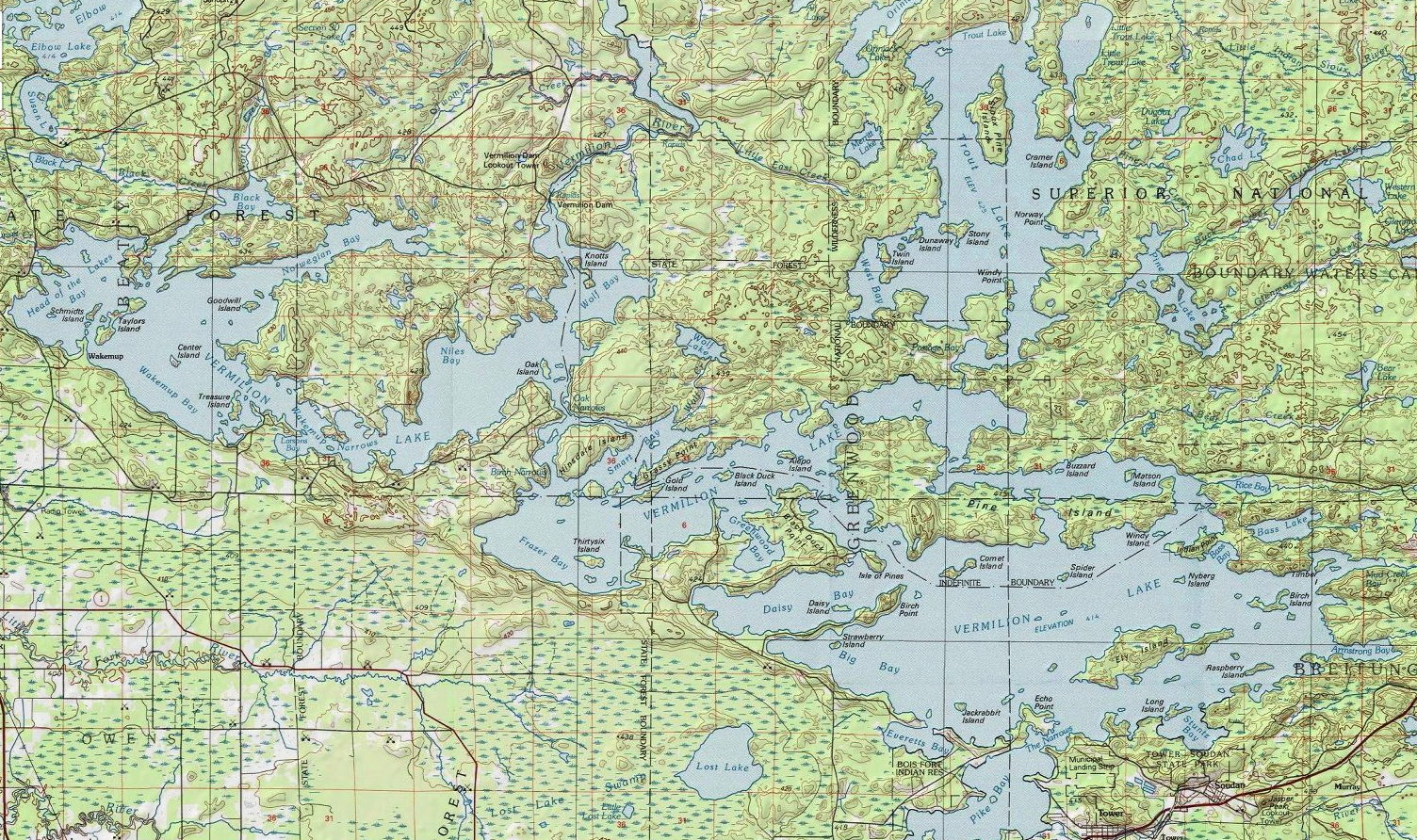
Vermilion Lake is listed in the Lakes Category for St. Louis County in the state of Minnesota. Vermilion Lake is displayed on the "Vermilion Dam" USGS topo map. The latitude and longitude coordinates (GPS waypoint) of Vermilion Lake are 47.89209 (North), -92.37487 (West) and the approximate elevation is 1,358 feet (414 meters) above sea level. If you are interested in visiting Vermilion Lake you can print the free topographic map, terrain map, satellite/aerial images, and other maps using the link above. The location, topography, nearby roads and trails, and towns around Vermilion Lake (Lake) can be seen in the layers of this interactive map. If you have already visited Minnesota's Vermilion Lake in St. Louis County, the nearest Lakes are listed above for your consideration.