Mt. St. Helens, Before and After Photos and Maps

Topographic maps of mountains typically don’t change much over the years. Even volcanoes are unlikely to change for thousands of years (with the exception of receding glaciers these days). Mount St. Helens is a different story. When it blew on May 18th 1980, the topography of the mountain and the entire landscape around it changed dramatically. The surveyors at USGS had to redraw the map to show the massive crater, the mudflows, and the new dome building in the center. Here is a look at the three different USGS topo layers of Mt. St. Helens.
Mt. St. Helens Topographic Maps
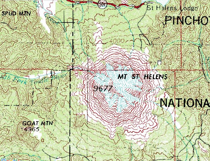
In this old USGS top level topo map below it shows that the volcano used to be a cone with a 9677 foot summit elevation.
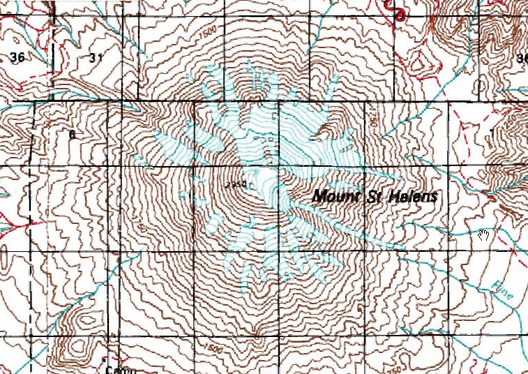
More detail can be seen in this grainy old mid-level map. It shows the individual glaciers and the near-perfect cone.
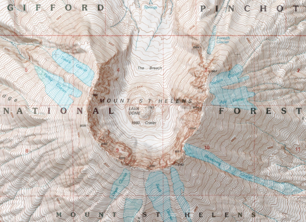
The new USGS 7.5 minute quadrangle map shows a horseshoe-shaped crater with the open end facing north (The Breach). The new summit is a high point on the crater rim at 8333 feet. This is quite an amazing difference! In this case, Mother Nature made a drastic change to one of her mountains and created a lot of extra work for the USGS map makers.
Before the eruption Spirit Lake was the source of the North Fork Toutle River. After the eruption and the lahar (mudflow), debris dammed up the lake and the source of the river became the volcano itself (the crater). This is a map of the debris flow.

Here’s how she looked before

Related Places
| Mountain | State |
|---|---|
| Mount Saint Helens | WA |
| Mount Saint Helens National Volcanic Monument | WA |
| The Breach of Mt. St. Helens | WA |
| North Fork Toutle River | WA |
| Spirit Lake | WA |