Guler Ice Cave Picnic Area Topo Map in Skamania County WA

Buy This Printed Topo Map

Print map | View map legend

Map Provided by TopoZone.com


Guler Ice Cave Picnic Area Information

Coordinates: 45.9609517°N, -121.6325803°W
Approx. Elevation: 2,821 feet (860 meters)
USGS Map Area: Little Huckleberry Mountain
Feature Type: Locale


Nearby Locales

Feature USGS Topo Map
Peterson Prairie Campground Little Huckleberry Mountain
Peterson Guard Station Little Huckleberry Mountain
Lava Caves and Bridges Trout Lake
Gablehouse Mill Guler Mountain
East Flattop Lookout Trout Lake
Smeltzer Mill Guler Mountain
West Flattop Lookout Trout Lake
Mount Adams Ranger Station Guler Mountain
Smoky Creek Campground Sleeping Beauty
Forlorn Lakes Campground Gifford Peak


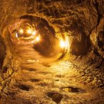
Lava tubes from nearby Mount Adams volcano created this cave that is reported to be 650 feet long. It gets the name Ice Cave because it’s often filled with ice stalagmites and stalactites from water that percolates down through the cave ceiling.

It’s very dark and obviously cold in the cave so bring a good light and warm clothes if you plan to explore beyond the opening at the picnic area.

Guler Ice Cave Picnic Area is listed in the Locales Category for Skamania County in the state of Washington. Guler Ice Cave Picnic Area is displayed on the "Little Huckleberry Mountain" USGS topo map. The latitude and longitude coordinates (GPS waypoint) of Guler Ice Cave Picnic Area are 45.9609517 (North), -121.6325803 (West) and the approximate elevation is 2,821 feet (860 meters) above sea level. If you are interested in visiting Guler Ice Cave Picnic Area you can print the free topographic map, terrain map, satellite/aerial images, and other maps using the link above. The location, topography, nearby roads and trails, and towns around Guler Ice Cave Picnic Area (Locale) can be seen in the layers of this interactive map. If you have already visited Washington's Guler Ice Cave Picnic Area in Skamania County, the nearest Locales are listed above for your consideration.