Zebra Slot Canyon Topo Map in Garfield County UT
Zebra Slot Canyon Information
Coordinates: 37.66063°N, -111.41721°W
Approx. Elevation: 5,200 feet (1,585 meters)
USGS Map Area: Escalante
Feature Type: Valley
Nearby Valleys
| Feature | USGS Topo Map |
|---|---|
| Halfway Hollow | Tenmile Flat |
| Tunnel Slot Canyon | Escalante |
| Cottonwood Wash | Tenmile Flat |
| Big Horn Slot Canyon | Tenmile Flat |
| Alvey Wash | Tenmile Flat |
| Phipps Wash | Calf Creek |
| Little Valley | Sunset Flat |
| Left Hand Collet Canyon | Seep Flat |
| Right Hand Collet Canyon | Seep Flat |
| The Gulch | Red Breaks |
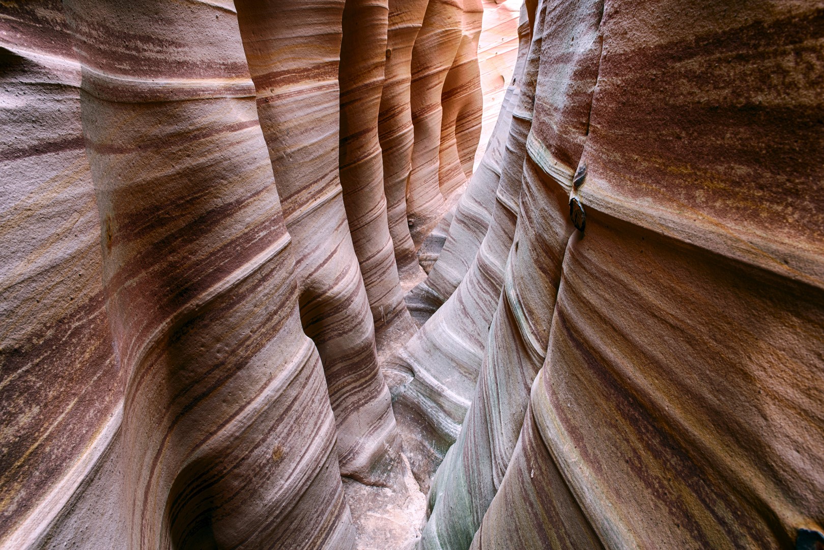
Zebra Slot Canyon is a short narrow slot that has horizontal strips of light and dark colors. It is typically visited at the same time as Tunnel Slot Canyon as the access trail is the same. You’ll find the trailhead on the Hole In The Rock Road which goes SE from Highway 2 starting about 5 miles east of the small town of Escalante, UT. Big Horn Slot Canyon could be seen at the same time as it is nearby. All three slots are located in Grand Staircase Escalante National Monument.
Zebra Slot Canyon is listed in the Valleys Category for Garfield County in the state of Utah. Zebra Slot Canyon is displayed on the "Escalante" USGS topo map. The latitude and longitude coordinates (GPS waypoint) of Zebra Slot Canyon are 37.66063 (North), -111.41721 (West) and the approximate elevation is 5,200 feet (1,585 meters) above sea level. If you are interested in visiting Zebra Slot Canyon you can print the free topographic map, terrain map, satellite/aerial images, and other maps using the link above. The location, topography, nearby roads and trails, and towns around Zebra Slot Canyon (Valley) can be seen in the layers of this interactive map. If you have already visited Utah's Zebra Slot Canyon in Garfield County, the nearest Valleys are listed above for your consideration.