Best Slot Canyons of the Desert Southwest
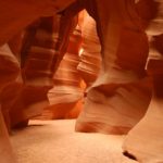
Antelope Canyon Why are slot canyons so attractive? Antelope Canyon in northern Arizona is one of the most photographed locations in America. It is a beautiful place with light peaking in through the narrow gap at the top of the canyon so I get that slot canyons are “attractive.” Maybe the better question is “what […]