Topographic Map of Mount Rainier National Park
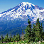
It’s hard to find a more majestic mountain anywhere on this planet than Mt. Rainier. It might not be the highest mountain in the world or in the United States, but it rises up to over 14,000 feet and starts closer to sea level than all the mountains in the Rockies. It’s volcanic history and […]