Maps of the Washington Volcanoes
Most Washingtonians know the five main volcanoes in their state, Rainier et al. Each is visible from somewhere along the Interstate 5 corridor, the main north-south route west of the Cascade Mountain Range. But when we were researching volcanoes in Washington we were surprised to discover that there are many more. Several have been active in recent geologic time while others have been extinct for years and no longer resemble volcanoes. A couple are well-known peaks that few know are old volcanoes.
Here are the Washington volcanoes from highest to lowest with links to their topo maps.
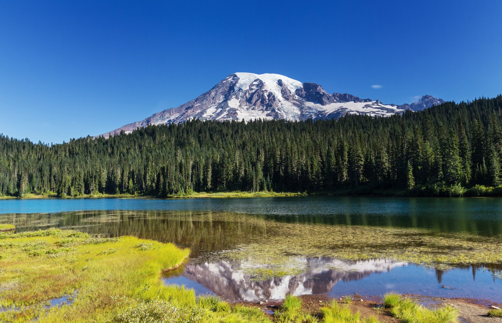 Mt. Rainier
The Main Five Volcanoes
Mount Rainier
Rainier is the highest at 14,411 feet and most visible of the five as it looks down on most of the Puget Sound Region and central Washington. Rainier is a common mountaineering objective with many routes from easy to difficult, but all requiring glacier travel and the related gear and training. Rainier, like the other four main volcanoes, is an active one.
Mount Adams
Adams is shorter than Rainier at 12,280 feet, but more voluminous as its base is much wider. Adams is a common hiking and backcountry skiing peak with a route on the south side that doesn’t require technical gear or experience. Many other climbing routes are available in various grades and classes.
Mount Baker
At 10,781 feet, Baker is visible from Seattle and the northern Puget Sound. It is commonly climbed via many different routes. Connected to Mt. Baker is an extinct volcano called the Black Buttes. Baker, a much younger active volcano, built itself in the same general space as the old dead one.
Glacier Peak
Glacier Peak is the most remote volcano of the big five. Road washouts and trail re-routes have made it even more difficult to reach in recent years. Hearty mountaineers still seek out the Glacier Peak summit which reaches up to 10,541 feet above sea level.
Mount St. Helens
St. Helens is probably the best-known internationally as it sent volcanic ash across the globe in May of 1980. This volcano used to be 9677 feet tall before the eruption, but she blasted away enough to bring the summit down to 8363 feet. While still attractive in her new condition, Mt. St. Helens was one good looking peak way back when. See St. Helens before and after.
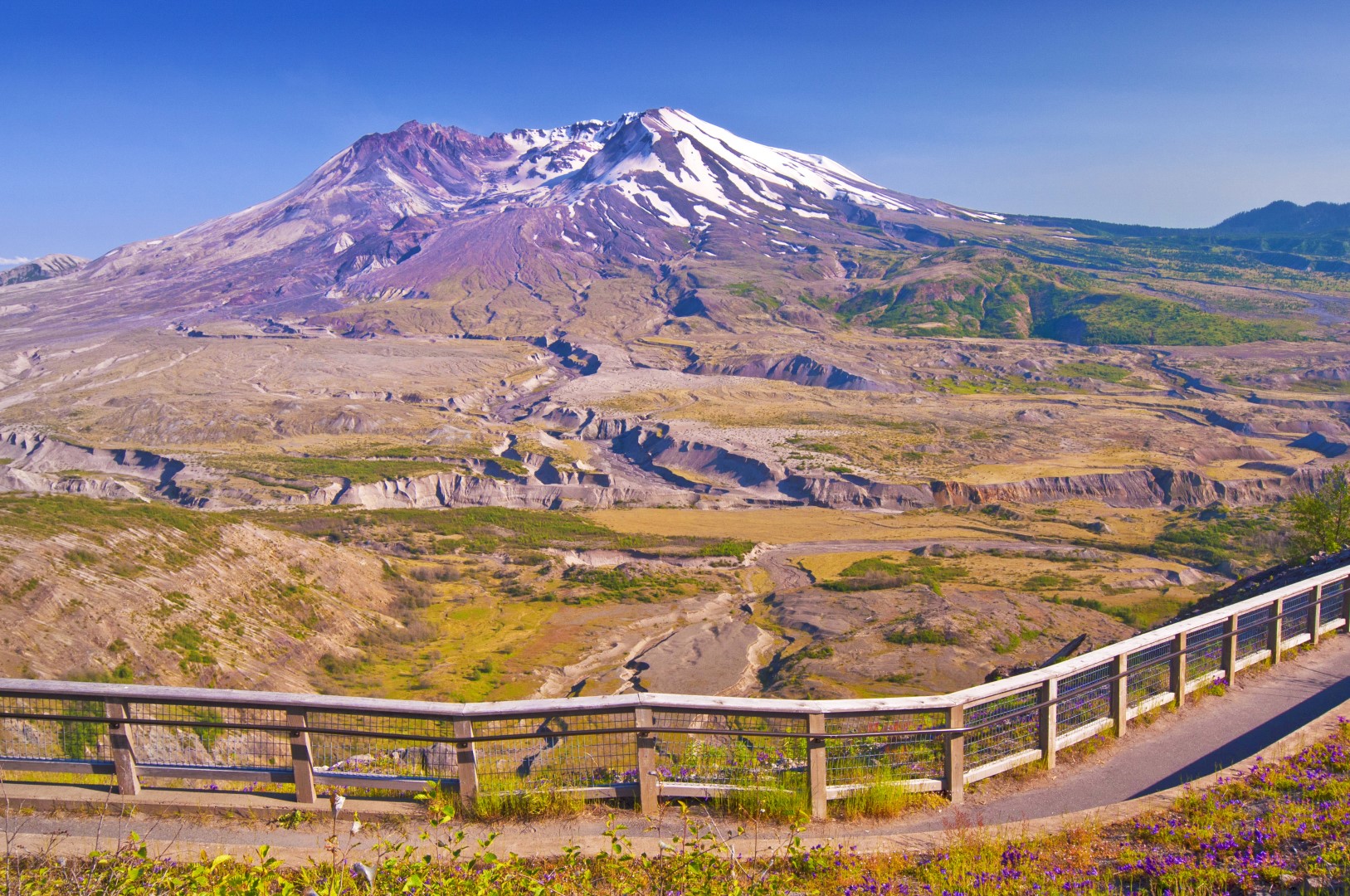 Mt. St. Helens
The “Unknown” Washington Volcanoes
Goat Rocks
The Goat Rocks are a well-known group of peaks that few people know is volcanic. They are the remnants of an extinct volcano about half way between Rainier and Adams. Goat Rocks Wilderness protects the highly eroded peaks that make up the range. Gilbert Peak is the highest remaining point on this volcano.
Silver Star Mountain
Silver Start is an extinct volcano in southern Washington (not to be confused with the more popular mountaineering destination of Silver Star Mountain near Mazama). It’s the southernmost of the Washington volcanoes and is only 27 miles from downtown Portland Oregon as the crow flies. The name comes from the ridges that radiate out like a star.
Indian Heaven Volcanic Field
This is a broad area southwest of Mt. Adams that has several small volcanoes that have created massive lava beds. The major peaks include Lemei Rock, East Crater, Gifford Peak, The Wart, and the Big Lava Bed Cinder Cone. Just outside of Indian Heaven Wilderness is Lone Butte which erupted up through a glacier leaving small volcano with steep sides.
Trout Creek Hill
This “hill” is a small shield volcano about ten miles north of the town of Stevenson on the Columbia River. It is located between Indian Heaven and Silver Star.
West Crater
West Crater is the name of a small volcano in southern Washington that created two large lava fields that flowed NW and SE. Other than the massive lava flows, all that’s left is a small cinder cone covered in trees.
Simcoe Volcanic Field
Like Indian Heaven, this is a broad area with over 30 small cinder cone volcanoes. They stretch northward from Goldendale for about 30 miles. The major formations include Lorena Butte, Jackknife Butte, Carp Lake, Hagerty Butte, McKays Butte, and Simcoe Mountain a large shield volcano in the center of the field.
Battle Ground Lake
This lake was formed in the crater of a small extinct volcano near the town of Battle Ground in southwest Washington.
Related Places
| Mountain | State |
|---|---|
| Mount Rainier | WA |
| Mount Adams | WA |
| Mount Baker | WA |
| Glacier Peak | WA |
| Mount Saint Helens | WA |
| Black Buttes | WA |
| Goat Rocks Wilderness | WA |
| Gilbert Peak | WA |
| Silver Star Mountain | WA |
| Indian Heaven Wilderness | WA |
| Lemei Rock | WA |
| East Crater | WA |
| Gifford Peak | WA |
| The Wart | WA |
| Big Lava Bed | WA |
| Lone Butte | WA |
| Trout Creek Hill | WA |
| West Crater Volcano | WA |
| Simcoe Volcanic Field | WA |
| Lorena Butte | WA |
| Jackknife Butte | WA |
| Carp Lake | WA |
| Hagerty Butte | WA |
| McKays Butte | WA |
| Simcoe Mountain | WA |
| Battle Ground Lake | WA |
| Stevenson | WA |
| Goldendale | WA |
| Battle Ground | WA |