Mexican Hat Rock Topo Map in San Juan County UT
Mexican Hat Rock Information
Coordinates: 37.1741683°N, -109.8487334°W
Approx. Elevation: 4,370 feet (1,332 meters)
USGS Map Area: Mexican Hat
Feature Type: Pillar
Nearby Pillars
| Feature | USGS Topo Map |
|---|---|
| Alhambra Rock | The Goosenecks |
| Seven Sailors | Mexican Hat |
| Mule Ear | San Juan Hill |
| Lady in the Bathtub | Cedar Mesa South |
| Moses Rock | Moses Rock |
| Cowboy Hat | Slickhorn Canyon East |
| Government Bird Rock | Slickhorn Canyon West |
| Navajo Twins | Bluff |
| Sunbonnet Rock | Bluff |
| Hat Rock | Slickhorn Canyon East |
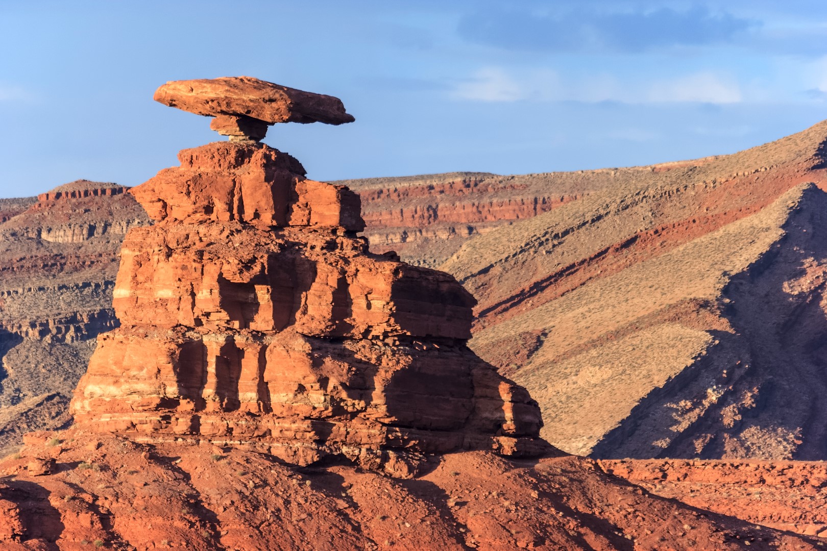
Mexican Hat Rock is a balanced hoodoo formed from eroded sandstone along the banks of the San Juan River near the town of Mexican Hat, Utah. From most directions this rock resembles a person wearing a poncho and a sombrero. It is visible from Highway 163 north of the town. Dirt roads and hiking trails can get curious visitors closer to the catatonic caballero.
Mexican Hat Rock is listed in the Pillars Category for San Juan County in the state of Utah. Mexican Hat Rock is displayed on the "Mexican Hat" USGS topo map. The latitude and longitude coordinates (GPS waypoint) of Mexican Hat Rock are 37.1741683 (North), -109.8487334 (West) and the approximate elevation is 4,370 feet (1,332 meters) above sea level. If you are interested in visiting Mexican Hat Rock you can print the free topographic map, terrain map, satellite/aerial images, and other maps using the link above. The location, topography, nearby roads and trails, and towns around Mexican Hat Rock (Pillar) can be seen in the layers of this interactive map. If you have already visited Utah's Mexican Hat Rock in San Juan County, the nearest Pillars are listed above for your consideration.