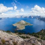
Lake Waiau Information
Coordinates: 19.8114053°N, -155.4775715°W
Approx. Elevation: 13,025 feet (3,970 meters)
USGS Map Area: Mauna Kea
Feature Type: Lake
This tiny natural pool is one of Hawaii’s only lakes. It’s at 13,020 feet of elevation and near the summit of Mauna Kea on the Big Island (Hawaii County). It has evaporated to almost nothing in the past, but it’s usually around 7 feet deep and that makes it the deepest lake in the state!
There is a parking lot for Lake Waiau on the right side of the Mauna Kea Access Road (elevation 12,800). Park there and walk across the road going west. The trail ascends the side of a couple cinder cones then drops down to the pond in the remnants of one of the cones known as Pu’uwaiau.
The water is usually a picturesque greenish color and has lava rocks all around the shoreline. At this elevation there can be snow around the lake especially in the winter months. Bring an extra layer of clothes when you visit and you’ll enjoy a nice hike. Remember the air is thin at this altitude so take it easy on the hike. You’ll want to stop at the visitor center on the drive up to acclimate a bit. If you have extra energy and are not gasping for breath then hike to the summit of Pu’uwaiau but start from the saddle that you crossed over to get to the lake.
Lake Waiau is listed in the Lakes Category for Big Island County in the state of Hawaii. Lake Waiau is displayed on the "Mauna Kea" USGS topo map. The latitude and longitude coordinates (GPS waypoint) of Lake Waiau are 19.8114053 (North), -155.4775715 (West) and the approximate elevation is 13,025 feet (3,970 meters) above sea level. If you are interested in visiting Lake Waiau you can print the free topographic map, terrain map, satellite/aerial images, and other maps using the link above. The location, topography, nearby roads and trails, and towns around Lake Waiau (Lake) can be seen in the layers of this interactive map. If you have already visited Hawaii's Lake Waiau in Big Island County, the nearest Lakes are listed above for your consideration.
